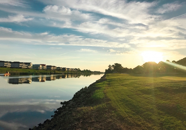
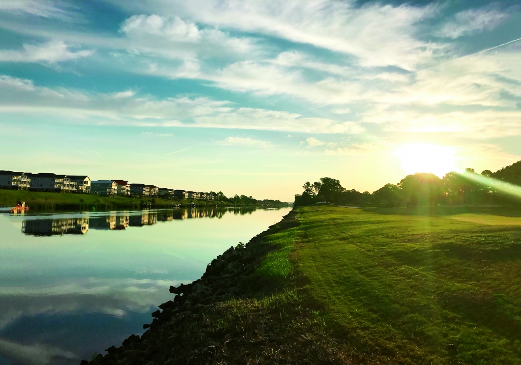
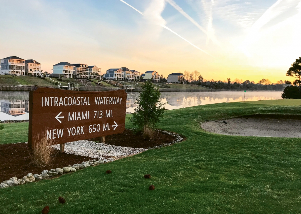
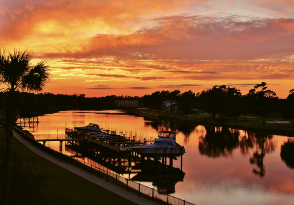
Along the Grand Strand, the Intracoastal Waterway is 60 miles of combined creeks, rivers and canals that make us a virtual island. We are touched by the waterway nearly every day. We live along it, drive over it, fish in it and go boating on it. We patronize numerous restaurants, marinas and other businesses located along it. We watch it anxiously every time there is a storm or significant rainfall. But, how much do we really know about it?


The Intracoastal Waterway started as a vision more than 240 years ago. Shortly after the American Revolution, key government and military leaders saw the need for a safe and secure route for shipping along the Atlantic coast but not on the open sea. The British blockade during the War of 1812 sealed the deal, and parts of the Intracoastal Waterway were in use in the Chesapeake region as early as 1829. The U.S. Army Corps of Engineers has been responsible for construction, maintenance and management of it since 1824, with certain supporting functions performed by the U.S. Coast Guard.
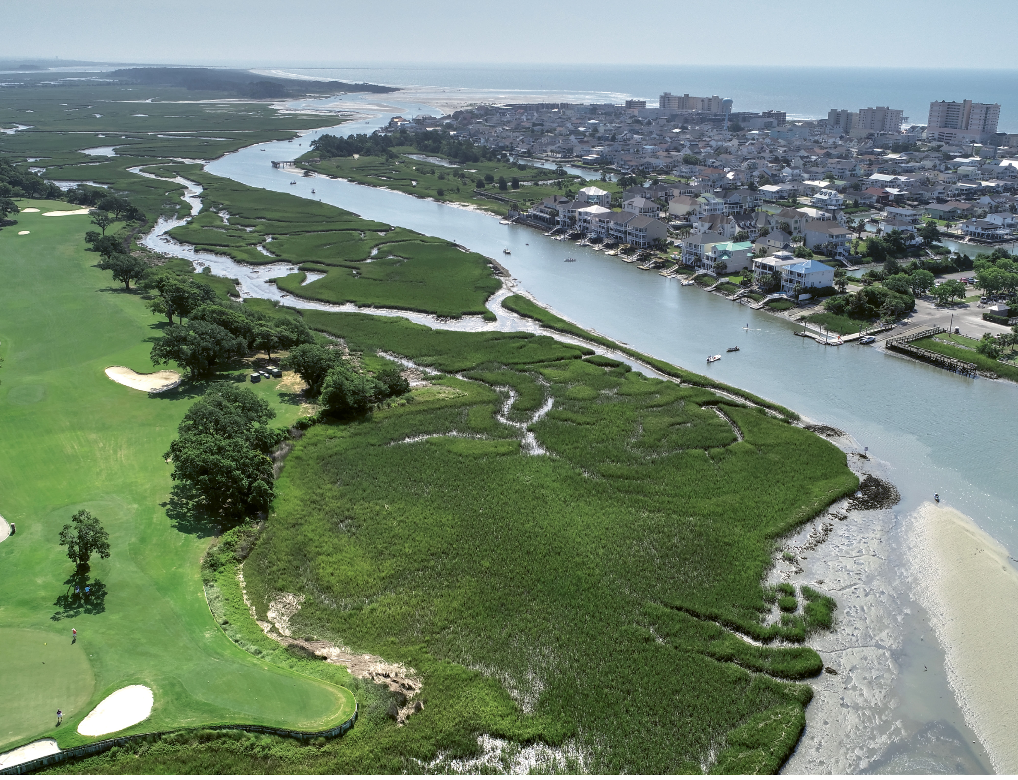
Today, this ribbon of life stretches more than 3,000 miles from New England in the north to Brownsville, Texas, in the southwest. The South Carolina portion was built from 1936 to 1940 and extends 210 miles from Little River to Hilton Head Island, according to Sara Corbett of the U.S. Army Corps of Engineers.
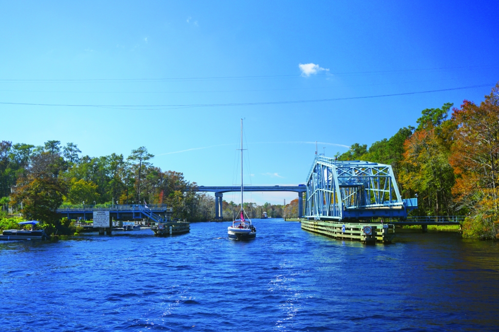
The Grand Strand portion begins at the mouth of Little River, ascends to its headwaters, then joins a manmade canal nearly 22 miles long that connects it to Socastee Creek and the Waccamaw River. From there, it follows the river southward to Winyah Bay in Georgetown. Northward from Little River, it follows a series of creeks, rivers and coastal sounds to Cape Fear. At times it is just two miles from the shore, while elsewhere it drifts several miles inland. Between Little River and Winyah Bay, 13 bridges cross it. Three are classic swing bridges—one in Socastee carrying Dick Pond Road, one at Barefoot Landing and one in Little River carrying Route 65. The others are all fixed bridges with a minimum height above the water of 65 feet. “The waterway averages 90 feet in width and 12 feet in depth, however the water body itself might be wider,” says Corbett.
A Modern Day Regional Asset
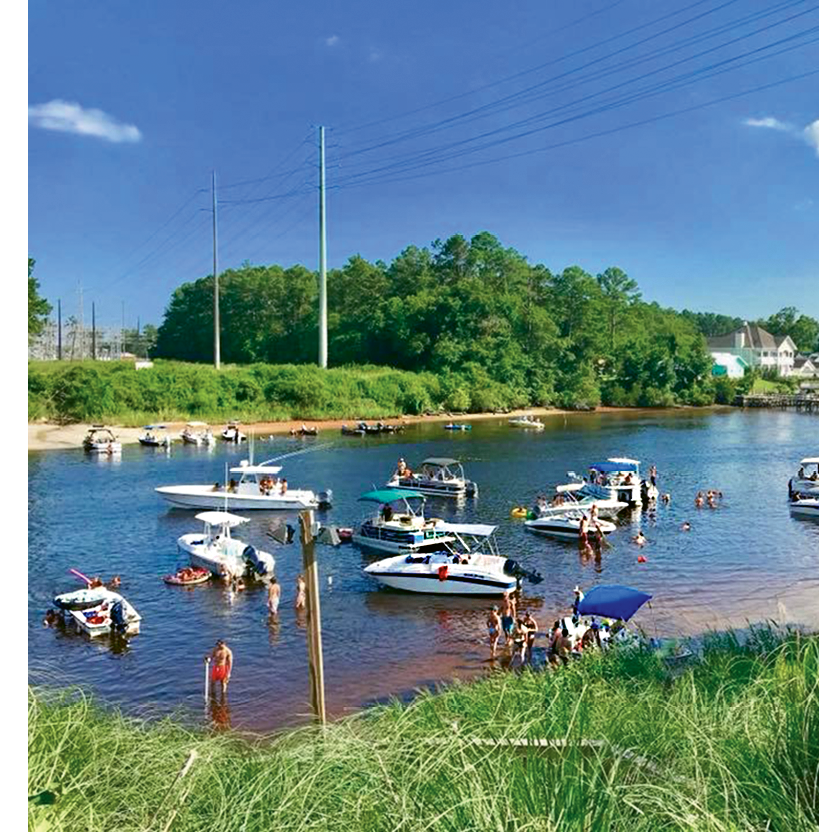
“The waterway is an extremely valuable regional asset,” says Sherry Harrelson, manager of the Osprey Marina in Socastee. “We see more than a thousand transient boaters and serious cruisers in any given year, plus countless locals enjoying the water. Our unique location provides well-protected fresh water close to the beaches and towns.”
Osprey Marina has been serving boaters for more than 20 years with fuel, supplies, groceries, dockage and storage. “We see an amazing array of wildlife,” remarks Miles Worrell, dockmaster. “Everything from deer, wild turkey, bald eagles, ducks, bluebirds, turtles, snakes, alligators, a wide variety of fish, and, of course, osprey! The ecology is a big attraction for boaters.”
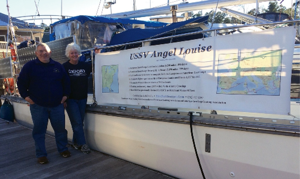
Sue and Ed Kelly are typical sailors who sail the waterway and dock overnight at Osprey often. Their accomplishments are far from typical, however. These two retired merchant marine officers have been sailing constantly since exiting their careers in 2007 and are the only known people on earth to have sailed both the Great American Loop (328 days/5,150 miles from Key West to Canada, up the St. Lawrence River, through the Great Lakes and down the Mississippi and back to Key West) and the Great European Loop (494 days/6,200 miles from London to the North Sea, to the Black Sea via the Rhine, Maine and Danube rivers, and out the Mediterranean past France, Spain and Portugal back to London).
“Since 2007, when we made our first travel through the Grand Strand, we have watched the growth of this great area,” says Ed. “In addition to visiting the Osprey Marina, we have visited the Barefoot Landing facilities and two other wonderful marinas on the Grand Strand in Myrtle Beach, as well as Georgetown.”
Beautiful Water Can Also Pose Risks
To truly get “immersed” in the waterway, its tributaries and marshes, talk to Dr. Nicole Elko, president of Elko Coastal Consulting based in Folly Beach. She serves as executive director of South Carolina Beach Advocates, a non-profit organization that works to preserve and protect the state’s waterways, marshes and shoreline. They are very active working with the state and federal government, as well as county and local municipalities to bolster funding and focus attention on needs like dredging, flood control, overdevelopment and wildlife environment. She also serves on Governor McMaster’s Floodwater Commission, which is studying solutions and economic incentives for better flood management, specifically the Commission’s Living Shores Task Force, which is examining ways of preserving the waterway and marshes.
“A major challenge ahead is securing the necessary funding for proper dredging and flood prevention,” says Dr. Elko. “Today, the waterway carries more recreational boating than the commercial shipping it was originally built for,” she continues. “But government leaders need to be convinced that the needs are just as important today. The waterway and coastal marshes are an amazing natural resource and home to literally thousands of species, including insects, reptiles, fish, shellfish, mammals, birds and waterfowl.”
Dr. Elko’s network extends to Coastal Carolina University, where numerous faculty and students are involved in the waterway in one way or another.
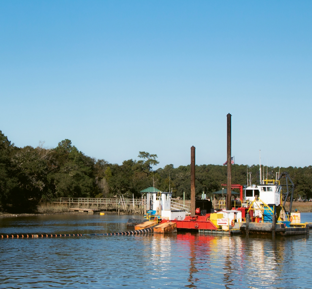
“As a result of flooding from recent hurricanes and storms, development along the waterway is under intense scrutiny,” says Dr. Jim Luken, associate provost of graduate studies and professor of biology at CCU’s College of Science. “Building new structures on stilts and pillars may not be enough. Storm runoff needs better management. Silt and sediment leads to shallow depth, which then requires dredging, but dredging needs to be carefully studied. Boaters need to respect the waterway like any public resource, reporting cases of littering and dumping. And recreational fishermen should practice catch and release to avoid stock depletion.”

Committing Resources For The Common Good
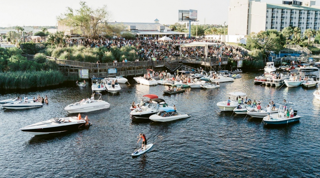
No one really tracks the exact number of vessels that use the waterway in a given year, but the South Carolina Department of Natural Resources (SCDNR) reports that it is one of the state’s most congested waterways. “As a major tourist destination, it draws millions of visitors to our state,” SCDNR states. “Several marine industries have sprung up from this influx of people, from restaurants on the water’s edge, to boat/Jet Ski rentals, inshore and offshore fishing excursions, marinas and more. Everybody wants to be on the water enjoying our precious natural resources. It presents a challenge to our officers to patrol for the safety of all on the water, and to ensure adherence to fisheries law.”
The U.S. Coast Guard also patrols the waterway and manages the infrastructure. Lt. Jr. Grade Phillip VanderWeit says, “This includes bridge permitting, installing and maintaining visual and electronic aids to navigation, participation in other permitting activities, coordination with the U.S. Army Corps of Engineers and a host of other agencies, and coastal and marine spatial planning activities that seek to reduce conflict between the various uses of the waterways.”
Additionally, the Coast Guard actively communicates known hazards, aid to navigation discrepancies, and marine construction work via Local Notice to Mariners, Radio Broadcast and Marine Safety Information Bulletins. There are more than 500 aids to navigation in this area alone, including lights, buoys, day boards, ranges and a lighthouse.
The Army Corps is responsible for maintaining the channel depth and approving the construction of docks, piers and wharves. Several agencies patrol the waterway, including the Coast Guard, SCDNR and police, sheriff, beach patrol and fire/rescue at the state, county and local levels.
In addition to the need for dredging, Lt. VanderWeit said the removal of marine debris and derelict/abandoned vessels seem to be among the biggest challenges at the moment.
Abandoned and derelict vessels are a chronic problem in our coastal environment. In addition to the direct impact on fragile marsh habitat, they diminish the safe recreational use of our waterways and are a visual blight on the landscape. Since 2004, the S.C. Department of Health and Environmental Control has worked with federal, state and local partners to leverage the removal of more than 100 abandoned vessels from coastal waterways stretching from Horry County to Hilton Head.

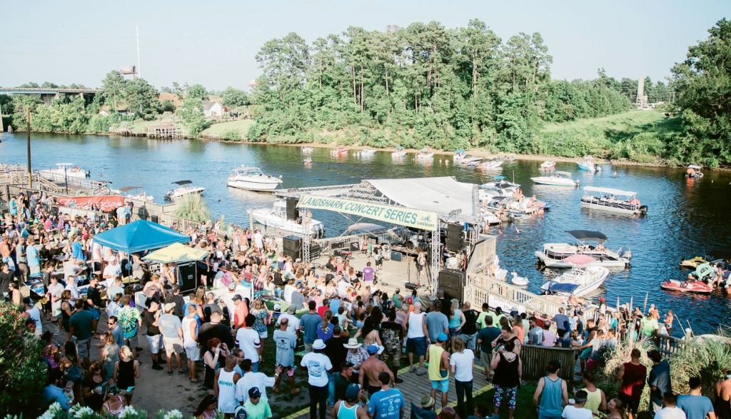
Dining, Dancing, Sunsets and More
The Intracoastal Waterway has provided a natural setting for numerous businesses that Grand Strand residents and visitors enjoy year-round, but particularly in season. The Boathouse, situated on the waterway near the former Fantasy Harbor, provides waterside dining and features an outdoor stage where numerous bands perform throughout the season. Deck 383 at Wacca Wacce Marina is one of the best places along the Grand Strand to catch beautiful sunsets as sailboats and motor yachts glide by. They also feature terrific food, beverages and entertainment. At the north end in Little River, those who enjoy waterside dining can choose from Captain Archie’s or Filet’s Waterfront. And at Barefoot Landing, Flying Fish, Taco Mundo, LuLu’s and Greg Norman’s Australian Grille feature dining options that overlook the waterway, complete with spectacular sunset views.
So this vital local resource affects our lives along the Grand Strand every day in numerous ways. It has historical significance, an enormous positive influence on our region’s ecology and is looked after by numerous government and private entities. But, it’s up to each of us to do our part as well to make sure the waterway remains a “ribbon of life” for future generations.
Resources for Safety on the Water:
Major portions of the Intracoastal Waterway are naturally deep, but there are numerous areas with depths of less than six feet due to excessive shoaling. Mariners are urged to review the Army Corps of Engineers’ most recent periodic survey information, which can be viewed here:
www.sac.usace.army.mil/Missions/Navigation/Channel-Conditions
www.sac.usace.army.mil/Missions/Navigation/Hydrographic-Maps
Additionally, the Coast Guard will initiate radio broadcast for areas reported to be shallower than charted. These areas will be investigated by either the local Coast Guard Unit, or local/state agencies. If shoaling is confirmed, an entry to the local notice to mariners will be established and a chart correction will be requested.
Interesting Facts: